樊风雷
博士,教授,博导 地理科学学院
研究方向: 城市遥感,高光谱遥感
fanfenglei@gig.ac.cn

教育背景

1997-2001    聊城师范学院地理系    本科    资源环境与城乡规划管理专业

2002-2006   中科院广州地球化学研究所    博士(硕博连读)  环境科学专业 (导师:王云鹏 研究员)

工作经历

2001-2001    山东省委组织部选调(任山东省鱼台县渔城镇副镇长)

2002-2002    山东省济宁市第一中学 (中教二级)

2006-            华南师范大学地理学院

                    (2008年副教授,2009年硕导,2013年教授,2017年博导,2022年三级教授)

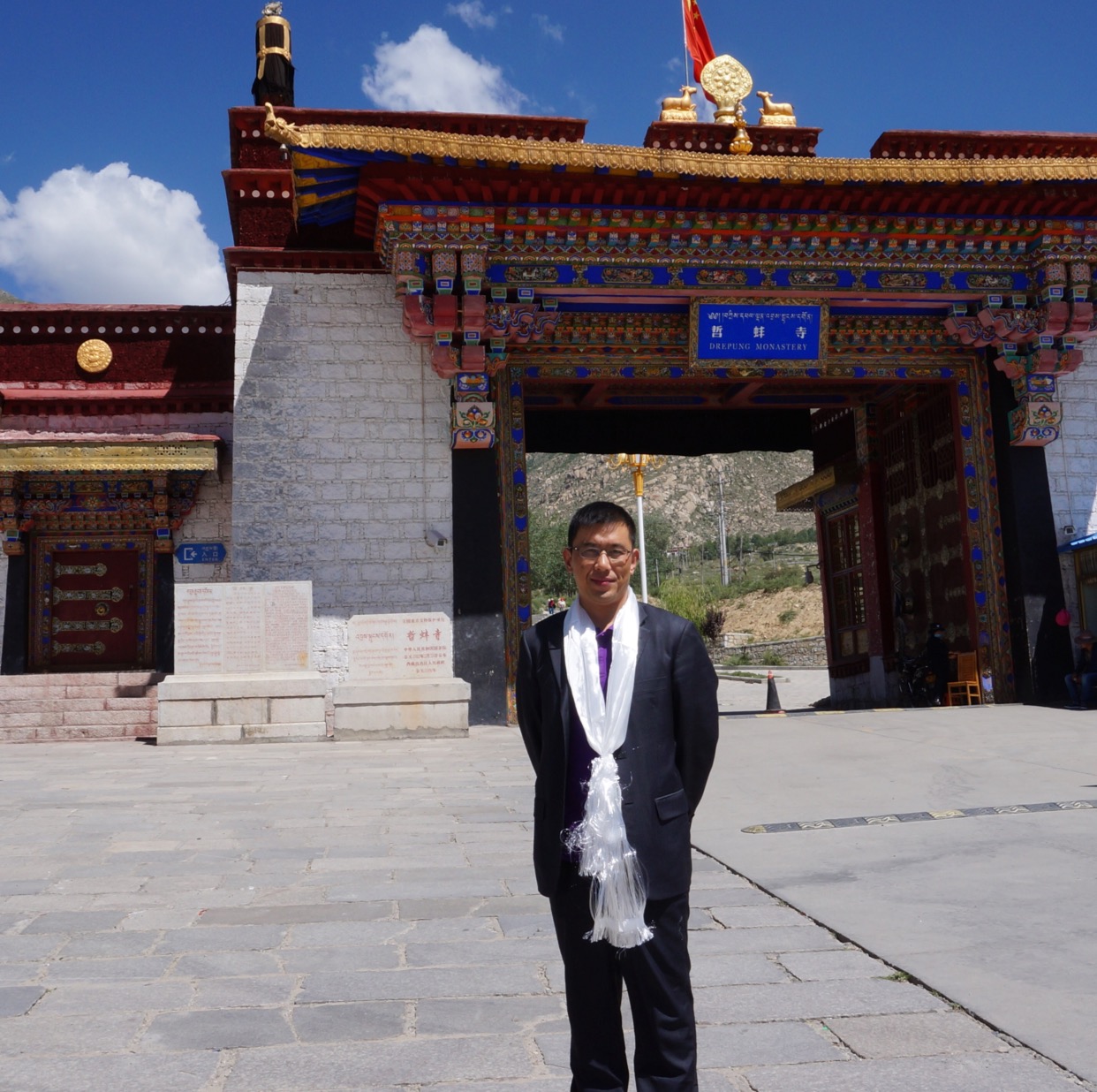
2015-2016     中组部第七批援藏干部,西藏大学旅游与外语学院副院长

2019-2020    地理信息科学系系主任,遥感与地理信息系统支部书记

2020- 2023    华南师范大学科技处副处长(挂职)

开设课程

环境遥感(广东省线下一流本科课程)

土地信息学

科研项目

国家社科基金重点项目(民族学No:21AMZ011)-西藏唐卡年代谱系分析及佛像形态空间结构演化研究.主持(2021-2023)
国家自然科学基金. MESMA改进算法的城市不透水面高光谱信息提取研究.  主持.(2013-2015)
广东省自然科学基金面上项目-耦合光学和雷达遥感时序数据的植被物候高精度提取模型研究,主持,(2024-2026)
广东省自然科学基金面上项目
-基于MESMA方法的不透水面提取及对InVEST模型的优化研究.主持.2021-2023
广州市科技计划项目(No:
202201010099)-深度学习CNN的广州市LCZ分类提取及热岛效应研究, 主持.2022-2024
华南师范大学哲学社科重大培育项目(ZDPY2206
).唐卡视角下西藏民族文化融合进程与启示研究.主持.2022-2025
西藏生态遥感监测与数据处理项目.主持.2021-2022
广东省烟草专卖局科技项目计划. 基于无人机遥感技术的烟草精细化管理.   主持.(2017-2019)
新时代背景下南海区海洋产业创新发展研究, 主持,(2018-2019)
广东省海洋经济数据分时点空间可视化及制图,主持,广东省海洋发展规划研究中心, (2019-2020)
广东省烟草专卖局科技项目计划.广东省烟草生长状况遥感动态监测与病害预警研究.  主持, (2013-2015)
中央支持地方高校发展专项资金-资源环境与地理信息系统学科建设项目(GX2016341),主持,2016-2017
青藏高原南部河流地表水资源遥感监测与空间分析研究,西藏自治区教育厅,2016-2018;经费共同负责人
基于多源遥感影像的雅鲁藏布江流域水体污染与时空变化分析,西藏自治区科技厅,2017-2018;经费共同负责人
华南师大学青年教师科研培育基金.城市不透水面高光谱遥感特征及在像元混解中的应用.   主持,(2012-2014)
电子科技大中山学院委托项目.基于TM数据的中山五桂山保护区森林蓄积量时间序列研究.  主持, (2012-2013)
中科院地理所项目.成渝地区环境影响评价基础地理空间数据集成.  主持, (2012-2015)
863项目子课题. 珠江三角洲城市不透水面特征、分布及生态影响. 主持, (2007-2009)
福建省自然科学基金.福建省城市竞争力指标体系构建及应用研究.  第二主持, (2006-2008)
广州市人口发展战略研究课题. 广州市人力资源开发决策支持与评估管理地理信息系统研究.  第三主持, (2009)
华南师范大学综设性实验项目.遥感数字图像处理软件操作与应用.   主持,(2010-2015)
华南师范大学2014年度质量工程建设项目-地理信息系统专业综合改革试点. 主持。(2014-2015)
Research Grants Council (RGC): Improving the estimation of impervious surfaces.... urban areas. CI

学术成果

    主要研究方向为土地利用/覆盖与变化遥感监测(Land Use and Land Cover Change Based on Remote Sensing Imagery)、城市不透水面高光谱遥感提取(Urban Impervious Surface Area Extraction Using Hyperspectral Remote Sensing Data)、西藏生态安全及监测。在土地利用变化、城市扩展、城市经济、城市演变、城市内涝、城市化进程、生态监测等方面做出了大量的研究成果。近年来共发表学术论文近百篇,在国际知名遥感和GIS学术期刊上发表SCI论文50篇,EI论文10篇,他引率达900多次。
    自2006年以来,课题组致力于土地利用变化遥感监测以及城市不透水面研究工作,在以下方面做出了一些有意义的探索:1)发现了手动端元选取优于PPI选取这一现象(2007,遥感技术应用);2)较早地利用LSMA方法提取大范围城市不透水面(2012,Sensors);3)利用不透面数据成功地改进和简化了传统的水文SCS-CN模型(2013,Remote Sensing);4)基于不透水面视角审视了广州城市内部扩张问题(2014,JFAE;2015,JARS:);5)评价和改进了多端元混解模型MESMA,提出了MESMA-SASD模型,优化了模型的提取精度(2014 JAG);6)发展了遥感指数在不透水面提取精度提升中的应用(2015,CJRS);7)利用不透水面对LUR模型进行了改进,反演了PM2.5的空间浓度(2018,Geo-Spatial Information Science);8)基于城市不透水面构建了生态评价模型并对珠三角生态进行了分级(2016,EMAS);9)讨论了城市不透面尺度效应对提取精度的影响(2019,JSTARS); 10)探讨了不同尺度遥感数据提取不透水面的精度差异(地球信息科学学报,2019)。同时,我们还完成了珠三角和粤港澳大湾区的土地利用和生态遥感监测工作,得到了广泛的关注(2007,Sensors;2007,EMAS;2009,IJGIS;2018,热带地理;2018,应用生态学报)。
    近年来,课题组以西藏为研究区域,在西藏生态环境变化、西藏人文环境演变、西藏地表参数提取等方面开展了卓有成效的工作。课题组构建了西藏地区生态系统服务评价指标和评价体系,形成了西藏湿地和西藏地质滑坡深度学习算法,同时完成了西藏地表参数人类活动影响测算工作,课题组同时开展了西藏生态环境和农业环境的长时间序列演化研究工作,在长时间序列模型构建和农业物候等方面已经获得有价值的科学发现。

Zhuoling Lin, Yaduo Zhang, Xiaoliang Liang, Guangqing Huang, Fenglei Fan*, Xiaoling Yin, Zhihao Chen, 2024. Spatial distribution of rare earth elements and their impact factors in an area with a high abundance of regolith-hosted deposits,  Chemosphere, 352,2024,141374, https://doi.org/10.1016/ j.chemosphere. 2024.141374.

Yudan Yang, Fenglei Fan*,2023.Land surface phenology and its response to climate change in the Guangdong-Hong Kong-Macao Greater Bay Area during 2001–2020,Ecological Indicators,
154,2023,110728,https://doi.org/10.1016/j.ecolind.2023.110728.

Yudan Yang, Fenglei Fan*. 2023. Ancient thangka Buddha face recognition based on the Dlib machine learning library and comparison with secular aesthetics. Herit Sci 11, 137 (2023). https://doi.org/10.1186/ s40494-023-00983-8


Sai Wang, Fenglei Fan* 2023.Thangka Hyperspectral Image Super-Resolution Based on a Spatial-Spectral Integration Network. Remote Sensing,15(14)3603. https://doi.org/10.3390/rs15143603

Sisi Wang, Xin Tan, Fenglei Fan*. 2023. Ecological Risk Assessment and Impact Factor Analysis of the Qinghai–Tibetan Plateau. Remote Sensing, 14, 4726. https://doi.org /10. 3390/rs14194726

Sisi Wang, Xin Tan, Fenglei Fan*.2023. Changes in Impervious Surfaces in Lhasa City, a Historical City on the Qinghai–Tibet Plateau. Sustainability 2023, 15, 5510. https://doi. org/ 10.3390/su15065510

Linlin Wu, Fenglei Fan*.2022. Multi-criteria framework for identifying the trade-offs and synergies relationship of ecosystem services based on ecosystem services bundles. Eco logical Indicators. https://doi.org/10.1016/ j.ecolind.2022.109453

Feng, Shanshan, Fenglei Fan*. 2022. Developing an Enhanced Ecological Evaluation Index (EEEI) Based on Remotely Sensed Data and Assessing Spatiotemporal Ecological Quality in Guangdong–Hong Kong–Macau Greater Bay Area, China. Remote Sensing 14, no. 12: 2852. https://doi.org/10.3390/rs14122852

Chuncheng Song, Caige Sun, Jianhui Xu, Fenglei Fan,2022. Establishing coordinated development index of urbanization based on multi-source data: A case study of Guang dong-Hong Kong-Macao Greater Bay Area, China. Ecological Indicators, https://doi.org /10.1016/j.ecolind.2022.109030.

Linlin Wu, Fenglei Fan*, 2022, Assessment of Ecosystem Services in New Perspective: A Comprehensive Ecosystem Service Index (CESI) as a Proxy to Integrate Multiple Eco system Services. Ecological Indicators,  https://doi.org/10.1016/j.ecolind.2022.108800

Defang Liu, Junjie Li, Fenglei Fan*, 2022, Recognition of landslide triggers in southeast Tibetan (China) using a novel lightweight network. Environmental Earth Sciences, http s://doi.org/10.1007/s12665-022-10356-2

Shanshan Fenglei; Fenglei Fan*. 2021. Impervious surface extraction based on different methods from multiple spatial resolution images: a comprehensive comparison. Internati onal Journal of Digital Earth. https://doi.org/10.1080/17538947.2021.1936227

Sai, Wang; Fenglei Fan*; 2021. Analysis of the Response of Long-Term Vegetation Dynamics to Climate Variability Using the Pruned Exact Linear Time (PELT) Method and Disturbance Lag Model (DLM) Based on Remote Sensing Data: A Case Study in Guang dong Province (China). Remote Sensing, 13, no. 10:1873.  https://doi.org/ 10.3390/rs131 01873

Peng, Ting; Sun, Caige; Feng, Shanshan; Zhang, Yongdong; Fan, Fenglei. 2021. Temp oral and Spatial Variation of Anthropogenic Heat in the Central Urban Area: A Case Stu dy of Guangzhou, China. ISPRS Int. J. Geo-Inf. 10, no. 3: 160.https://doi.org/10.3390/ijg i10030160

Linlin Wu; Caige Sun*; Fenglei Fan2021. Estimating the Characteristic Spatiotemporal Variation in Habitat Quality Using the InVEST Model - A Case Study from Guangdong–Hong Kong–Macao Greater Bay Area. Remote Sensing, 2021, 13(5). 
https://doi.org/ 10.3390/rs13051008 (高被引论文)

Defang Liu*; Junjie Li; Fenglei Fan2021. Classification of landslides on the south eastern Tibet Plateau based on transfer learning and limited labelled datasets. Remote Sensing Letters, 12(3): 286-295. https://doi.org/10.1080/2150704X.2021. 1890263

Sun, Caige; Zhang, Shengyong*; Song, Chuncheng; Xu, jianhui; Fan, Fenglei2021. Investigation of Dynamic Coupling Coordination between Urbanization and the Eco-Environment-A Case Study in the Pearl River Delta Area. Land, 2021, 10(2). https:// doi.org/10.3390/land10020190

Shanshan Feng; Fenglei Fan*2021. Analyzing the Effect of the Spectral Interference of Mixed Pixels Using Hyperspectral Imagery. IEEE Journal of Selected Topics in Applied Earth Observations and Remote Sensing, 2021, 14(14): 1434-1446. https://doi.org/10. 1109/ JSTARS.2020.3045712

Caige Sun; Hao Chen; Fenglei Fan*2020. Improving Accuracy of Impervious Surface Extraction Based on a Threshold Hierarchical Method (THM). Applied Sciences-Basel, 2020, 10(23). https://doi.org/10.3390/app10238409

Shanshan Feng; Fenglei Fan*; 2019. A hierarchical extraction method of impervious surface based on NDVI thresholding integrated with multispectral and high-resolution remote sensing imageries. IEEE Journal of Selected Topics in Applied Earth Observa tions and Remote Sensing, https://doi.org/10.1109/JSTARS.2019.2909129

Fenglei Fan *; Runping Liu; 2018. Exploration of spatial and temporal characteristics of PM2.5 concentration in Guangzhou, China using wavelet analysis and modified land use regression model. Geo-spatial Information Science, 21:4, 311-321, https://doi.org/10. 1080/10095020.2018.1523341

Zhang, Jinqu
Zhu, YunqiangFan, Fenglei*2016. Mapping and evaluation of landscape ecological status using geographic indices extracted from remote sensing imagery of the Pearl River Delta, China, between 1998 and 2008. Environmental Earth Sciences, 2016.2.01, 754https://doi.org/10.1007/s12665-015-5158-0

Fenglei Fan, Wei Fan, Qihao Weng. 2015. Improving Urban Impervious Surface Mappin g by Linear Spectral Mixture Analysis and Using Spectral Indices. Canadian Journal of Remote Sensing. 41,1-10. 
https://doi.org/10.1080/07038992.2015.1112730


Fenglei Fan*, Yingbin Deng. 2014. Enhancing Endmember Selection in Multiple Endmember Spectral Mixture Analysis (MESMA) for Urban Impervious Surface Area Mapping Using Spectral Angle and Spectral Distance Parameters. International Journal of Applied Earth Observation and Geoinformation, 33:290-301. https://doi.org/10.1016 /j.jag.2014.06.011

Fenglei Fan*, Wei Fan. 2014. Understanding Spatial-temporal Urban Expansion Pattern (1990- 2009) Using Impervious Surface Data and Landscape Indexes: A Case Study in Guangzhou (China). Journal of Applied Remote Sensing, 8, 083609:1-15.https://doi.org /10.1117/1.JRS.8.083609 

Fenglei Fan, Yingbin Deng, Xuefei Hu, Qihao Weng*. 2013. Estimating Composite Curv e Number Using an Improved SCS-CN Method with Remotely Sensed Variables in Gua ngzhou, China. Remote Sensing, 5(3), 1425-1438. 
https://doi.org/10.3390/rs5031425

Fenglei Fan, Yingbin Deng, Yunqiang Zhu*.2013. Extracting impervious surface area and discussing urban expansion of Guangzhou (1990-2003) based on V-I-S model by using linear spectral mixture analysis method. Journal of Food, Agriculture & Environme nt, 11(2), 925-929.

Yingbin Deng, Fenglei Fan*, Renrong Chen. 2012. Extracting and analyzing the imper vious surface by using landsat TM/ETM+ imagery based on spectral un-mixing method from 1998 to 2008 in Pearl River Delta of China. Sensors, 12,1846-1862. https://doi.org/
10.3390/s120201846

Fenglei Fan, Yunpeng Wang*, Maohui Qiu, Zhishi Wang. 2009. Evaluating the temporal and spatial urban expansion patterns of Guangzhou from 1979 to 2003 by remote sensin g and GIS methods. International Journal of Geographical Information Science, 23(11), 1371-1388. https://doi.org/10.1080/13658810802443432


Fenglei Fan, Yunpeng Wang*, Zhishi Wang. 2008. Temporal and spatial change detect ing (1998-2003) and predicting of land use and land cover in core corridor of Pearl River Delta (China) by using TM and ETM+ images. Environmental Monitoring and Assessme nt, 137, 127-147. https://doi.org/10.1007/s10661-007-9734-y

Fenglei Fan, Qihao Weng, Yunpeng Wang*. 2007. Land Use and Land Cover Change in Guangzhou, China, from 1998 to 2003, Based on landsat TM/ETM+ Imagery. Sensors, 7, 1323-1342. https://doi.org/10.3390/s7071323

Runping Liu, Fenglei Fan*. 2014. Mass concentration variations characteristics of PM10 and PM2.5 in Guangzhou (China). In proceeding of: 2014 Third International Workshop on Earth Observation and Remote Sensing Application.

Wei Fan, Runping Liu, Fenglei Fan*. 2014. Spatiotemporal Change Analysis of Urban Land Surface Component Based on V-I-S Model --A case study in Guangzhou. In proceeding of: 2014 Third International Workshop on Earth Observation and Remote Sensing Application.

Fenglei Fan, Maohui Qiu, Yueliang Ma*, Wei Fan. 2012. Monitoring and analyzing water pollution of the Pearl River in Guangzhou section by using remote sensing images and field acquisition data. AISS: Advances in information science and service science. 4(8), 67-75.

Fenglei Fan, Caige Sun, Zongnuan Chen, Kaiwen Zhong, Yunpeng Wang. 2011. Monit oring the land use change and its conversion mechanism of economic core corridor of Pearl River Delta based on Remote Sensing data in recent years. JDCTA: International Journal of Digital Content Technology and its Applications,15 (10), 262-265.

Fenglei Fan, Dianguo Zhang. 2010. Study of AgI real time seeding index in cold strato cumulus. Journal of computational information system, 6(8), 2501-2510.

Fenglei Fan.2008.Digital Change Detection by Post-Classification comparison of RS Da ta in land Use of Guangzhou. Journal of Information and Computational Science. 5(3), 1061-1067.

Fenglei Fan, Yunpeng Wang. 2005. Farmland loss of Guangzhou from 1998 to 2003 using landsat TM/ ETM data and its economic implications. Geoscience and Remote Sensing Symposium 2005, 4(25-29), 2434-2437.

Yunpeng Wang, Fenglei Fan, et al. 2005. Urban-used land Change (1998-2003) and its Spatial Distribution of Shenzhen, China: Detected by Landsat TM/ETM+ data. Geoscience and Remote Sensing Symposium 2005, 4(25-29), 2339-2342.

Yunpeng Wang, Fenglei Fan, et al. 2004. Urbanization in Pearl River Delta area in past 20 years: remote sensing of impact on water quality. SPIE, 5544,124-134.


[1]邹富宝,付卓,樊风雷等.基于频率比与AHP模型的西藏东部地区滑坡易发性评价[J].自然灾害学报,2023,32(02):235-242 .DOI:10.13577/j.jnd.2023.0225.

[2]凡晚晴,吴华,樊风雷.20年来西藏地区NPP时空变化及影响因素[J].水土保持通报,2022,42(06):378-386. DOI:10.13961/j.cnki.stbctb.2022.06.045.

[3]伍健恒,孙彩歌,樊风雷.西藏地表温度时空演变特征及影响因子[J].冰川冻土,2022,44(05):1523-1538.

[4]彭婷,孙彩歌,张永东等.广州市中心城区人为热排放景观格局的时空变化[J].华南师范大学学报(自然科学版),2021,53(05):92-102.

[5]钟凯文, 城市不透水面高精度遥感监测与应用. 广东省,广州地理研究所,2021-02-26.

[6]冯珊珊,梁雪映,樊风雷等.基于无人机多光谱数据的农田土壤水分遥感监测[J].华南师范大学学报(自然科学版),2020,52(06):74-81.

[7]梁雪映,冯珊珊,郭颖等.基于无人机的烟草氮元素定量反演与空间差异分析[J].热带地貌,2020,41(02):18-26.

[8]刘畅,孙彩歌,樊风雷.基于多源数据的拉萨旅游空间结构分析[J].地理空间信息,2020,18(08):25-30+6.

[9]王塞,王思诗,樊风雷.基于时间序列分割算法的雅鲁藏布江流域NDVI(1985-2018)变化模式研究[J].生态学报,2020,40(19):6863-6871.

[10]伍健恒,孙彩歌,樊风雷.高原地区城市不透水面与地表温度时空分布研究[J].华南师范大学学报(自然科学版),2020,52(03):92-100.

[11]冯珊珊,樊风雷.Landsat/OLI与夜间灯光数据在提取城市不透水面中的精度差异分析[J].地球信息科学学报,2019,21(10):1608-1618.

[12]梁雪映,樊风雷.基于遥感光谱的作物氮含量估算研究进展[J].中国农业科技导报,2019,21(01):51-61.DOI:10.13304/j.nykjdb.2017.0893.

[13]冯珊珊,樊风雷.基于不透水面的粤港澳大湾区景观格局时空变化[J].应用生态学报,2018,29(09):2907-2914.DOI:10.13287/j.1001-9332.201809.013.

[14]冯珊珊,樊风雷.2006―2016年粤港澳大湾区城市不透水面时空变化与驱动力分析[J].热带地理,2018,38(04):536-545.DOI:10.13284/j.cnki.rddl.003042.

[15]齐婧冰,樊风雷.基于信息熵的山西太谷植被指数最佳分辨率尺度分析[J].广东农业科学,2017,44(01):167-171+193.DOI:10.16768/j.issn.1004-874X.2017.01.025.

[16]陈浩,樊风雷.基于集合卡尔曼滤波的南雄烟草LAI数据同化研究[J].生态学报,2017,37(09):3046-3054.

[17]齐婧冰,樊风雷,郭治兴.基于高光谱分形分析的烟草冠层生长状况监测[J].华南师范大学学报(自然科学版),2016,48(01):94-100.

[18]樊风雷,刘润萍,张佃国.一种改进的城市建筑用地信息提取方法及在广州地区的应用[J].华南师范大学学报(自然科学版),2014,46(04):98-102.

[19]杨静学,黄本胜,欧阳显良等.基于遥感技术的珠三角6类林分的蒸散比研究(英文)[J].Agricultural Science & Technology,2014,15(03):457-462.DOI:10.16175/j.cnki.1009-4229.2014.03.042.

[20]樊风雷,林文枫.城市交通噪声垂直空间分布规律GIS分析[J].测绘与空间地理信息,2013,36(08):4-7.

[21]樊风雷.城市不透水面高光谱遥感监测研究进展[J].云南地理环境研究,2013,25(02):57-64.

[22]樊风雷,邓应彬,樊蔚.基于遥感和GIS的中山市五桂山森林蓄积量时间序列分析[J].广东农业科学,2013,40(04):171-173+238.DOI:10.16768/j.issn.1004-874x.2013.04.063.

[23]杨静学,黄本胜,欧阳显良等.基于遥感技术的珠三角6类林分的蒸散比研究[J].广东农业科学,2013,40(03):125-128+131+237.DOI:10.16768/j.issn.1004-874x.2013.03.064.

[24]熊永柱,樊风雷,朱长柏等.广州市生态系统服务价值时空变化遥感监测[J].广东农业科学,2012,39(15):196-201+237.DOI:10.16768/j.issn.1004-874x.2012.15.017.

[25]樊风雷,邱茂慧.基于归一化植被指数的广州市植被时间变化分析[J].广东农业科学,2012,39(06):1-3+7+4.DOI:10.16768/j.issn.1004-874x.2012.06.003.

[26]樊风雷,陈冰.GIS支持下基于遥感数据珠江广州段污染监测分析[J].三峡环境与生态,2009,2(01):12-16.

[27]樊风雷.基于线性光谱混合模型(LSMM)的两种不同端元值选取方法应用与评价——以广州市为例[J].遥感技术与应用,2008(03):272-277+239-240.

[28]樊风雷,王云鹏.基于遥感数据的珠江三角洲核心区域土地利用时间序列变化分析[J].农业现代化研究,2008(02):223-226.

[29]樊风雷,陈忠暖.GIS支持下珠江三角洲土地利用变化(19802003)遥感监测研究述评[J].云南地理环境研究,2008(01):1-6+12.

[30]樊风雷,王云鹏.基于CA的珠三角核心区城市扩张预测研究[J].计算机工程与应用,2007(36):202-204+245.

[31]樊风雷,孙彩歌.1997—2003年广州市土地利用变化遥感监测研究及动态分析[J].生态科学,2007(06):546-552.

[32]樊风雷,邱茂慧,王云鹏.珠江三角洲经济核心区土地利用遥感监测及其转化机理[J].东华理工学院学报,2007(03):252-256.

[33]邹蒲,王云鹏,王志石等.基于ETM+图像的混合像元线性分解方法在澳门植被信息提取中的应用及效果评价[J].华南师范大学学报(自然科学版),2007(02):131-136.

[34]樊风雷. 珠江三角洲核心区域土地利用时空变化遥感监测及其生态环境效应研究[D].中国科学院研究生院(广州地球化学研究所),2007.

[35]邱茂慧,樊风雷.珠港澳地区111995~2004年城市竞争力评价研究[J].华南师范大学学报(自然科学版),2006(04):120-127.

[36]汤世华,樊风雷,王云鹏等.1998~2003年东莞市开发区时空变化的遥感监测及驱动力分析[J].华南师范大学学报(自然科学版),2006(01):114-119.

[37]汤世华,樊风雷,王云鹏等.土地利用变化的遥感监测及其与经济发展关系的研究——以增城市1998-2003土地利用为例[J].农业现代化研究,2005(05):378-381.

[38]樊风雷,王云鹏.基于MapObjects控件的中国矿情地理信息系统及应用——以铜矿地质分布为例[J].热带地理,2004(02):155-158+167.

[39]樊风雷,王云鹏.中国矿物数据库中图像数据最优存储和显示方法的探讨[J].计算机工程与应用,2004(08):170-173+176.
社会兼职

中国自然资源学会资源持续利用与减灾专业委员会委员(2022-2027)
中国遥感应用协会热带与极地环境遥感分会理事(2022-)
广东省遥感与地理信息系统学会第八届理事会理事(2021-2026)
广东省自然资源厅海洋规划与经济发展咨询专家库首批入库专家(2020-)
广东省高校科技成果转化专家库成员(2022-2027)

其他

博士后: 
 
孙彩歌   吴林霖

博士生:

冯珊珊(2019级、国家奖学金、优秀毕业生获得者)
吴林霖(2020级、国家奖学金、优秀毕业生获得者)
王塞(2022级)
王思诗(2017级、与天津大学联合培养)
刘德芳(2018级、与大连理工大学合作培养)
杨雨丹(2023级、国家奖学金获得者)

学术型硕士生: 

樊蔚(2011级、美国威斯康星攻读博士学位)、刘润萍(2012级、国家奖学金获得者)

黄司充(2013级)、 齐婧冰(2014级)、陈浩(2014级)、王钰(2015级)

冯珊珊(2016级)、 梁雪映(2017级)、王塞(2018级)、伍健恒(2019级)

彭婷(2019级,联合培养)、宋春城(2020级)、杨雨丹(2021级)、温睿(2022级)

黄淳昊(2022级)、荣萌(2023级)、曹乐乐(2023级)
   
教育硕士: 
    
刘旦(2018级)、李文红(2018级)、刘婷(2019级)、 杨一见(2020级)、邱国伟(2021级)

西藏大学招生博士:

肖燕(2020级)、邱雅楠(2021级)、王晨(2021级)

西藏大学招生硕士:

邹富宝(2019级)、付卓(2019级)、王澳(2020级)、凡晚晴(2020级)、黄承信(2021级)、潘育萌(2022级)
EN